15th April 2023 12:00
First of all, I set out a budget for the trip, I usually aim for a round figure but it is always upwards of £5,000 - more than enough for a trip anywhere in the world for four to six weeks.
Don’t think you can load up the credit card and a way you go either.
Remember, travelling to rural, remote locations cash is king!
Money talks anywhere in the world, from bribes to transport costs to all in between.
15th March 2023 13:00
You would think I would need a break from travel after my last expedition, but, it isn’t long before I find my feet itching and the desire to fly away calling me.
However, planning an expedition is not a simple case of sticking a pin in the map and away you go.
No, it takes time. In my case, planning an expedition takes up to two years of research.
Firstly, you have to be drawn to a particular location. For me, there is always a reason behind why I want to go to a certain country.
It could be an animal I would love to see in its natural habitat, or simply the culture of the location that draws me in, making me want to experience it for myself.
15th February 2023 12:00
That saying ‘can’t wait to get home and have a cuppa’ is no lie.
Be it a freshly brewed cup of tea, catching your favourite tv show or climbing into your own bed, as much as we can’t wait to go away, coming home to our creature comforts is a feeling you truly can not beat.
But for me, there was something else, my comfort was in being able to say ‘I did it. I proved you wrong’
15th January 2023 13:00
I felt sick, I felt overwhelmed, I felt relieved.
Is it really possible to have so many feelings hit you simultaneously?
The truth is ‘yes’
15th December 2022 14:00
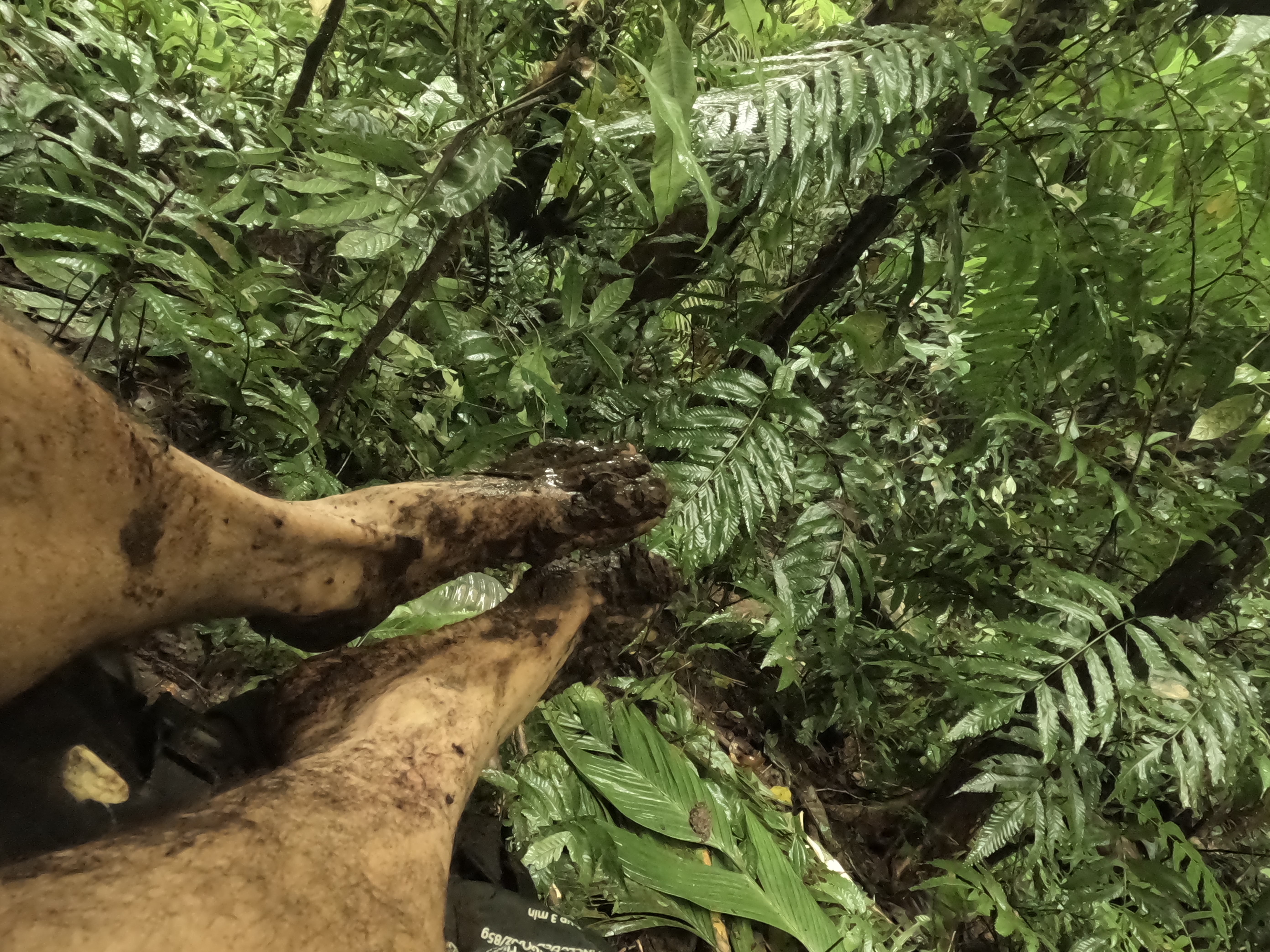
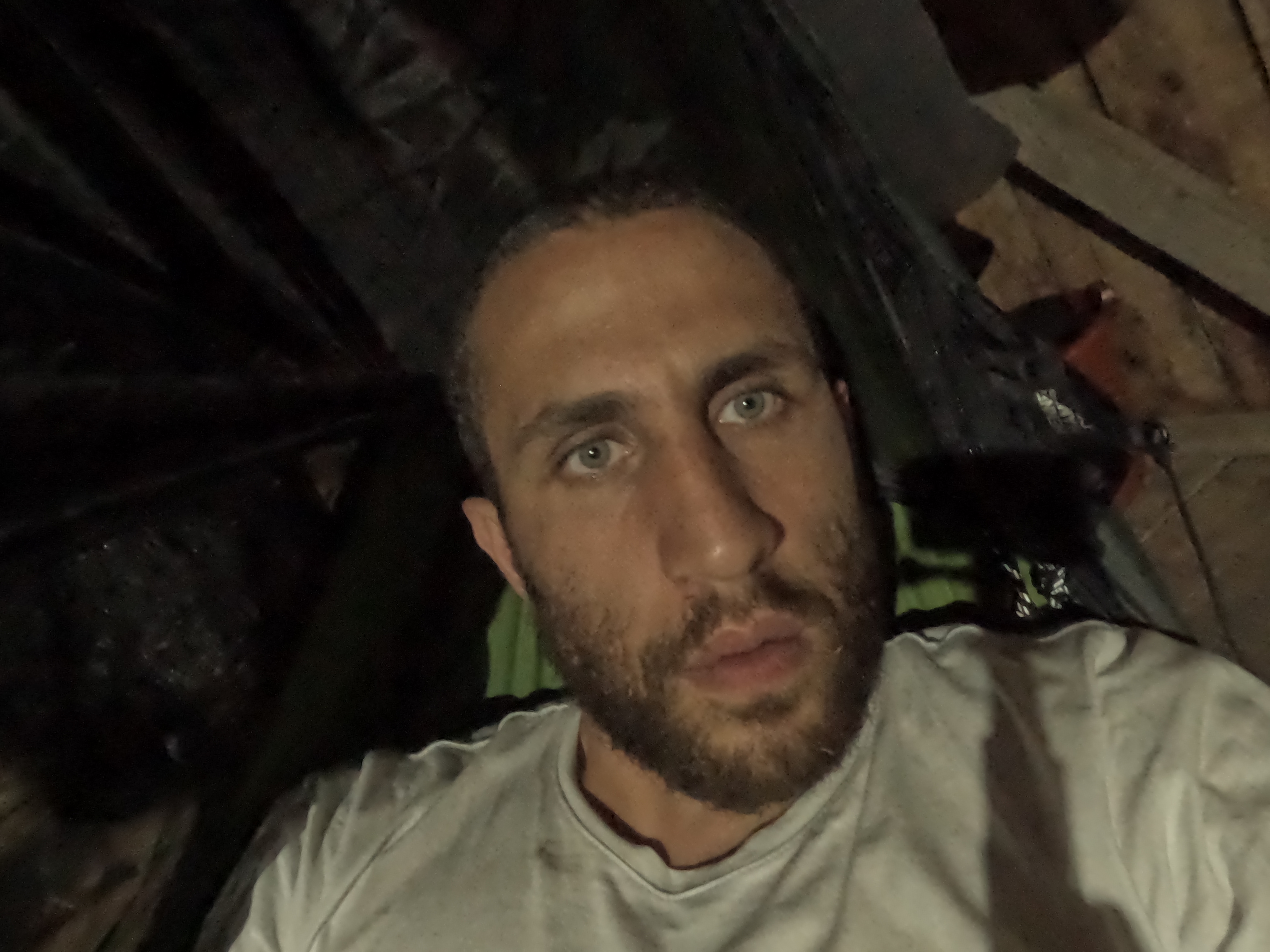
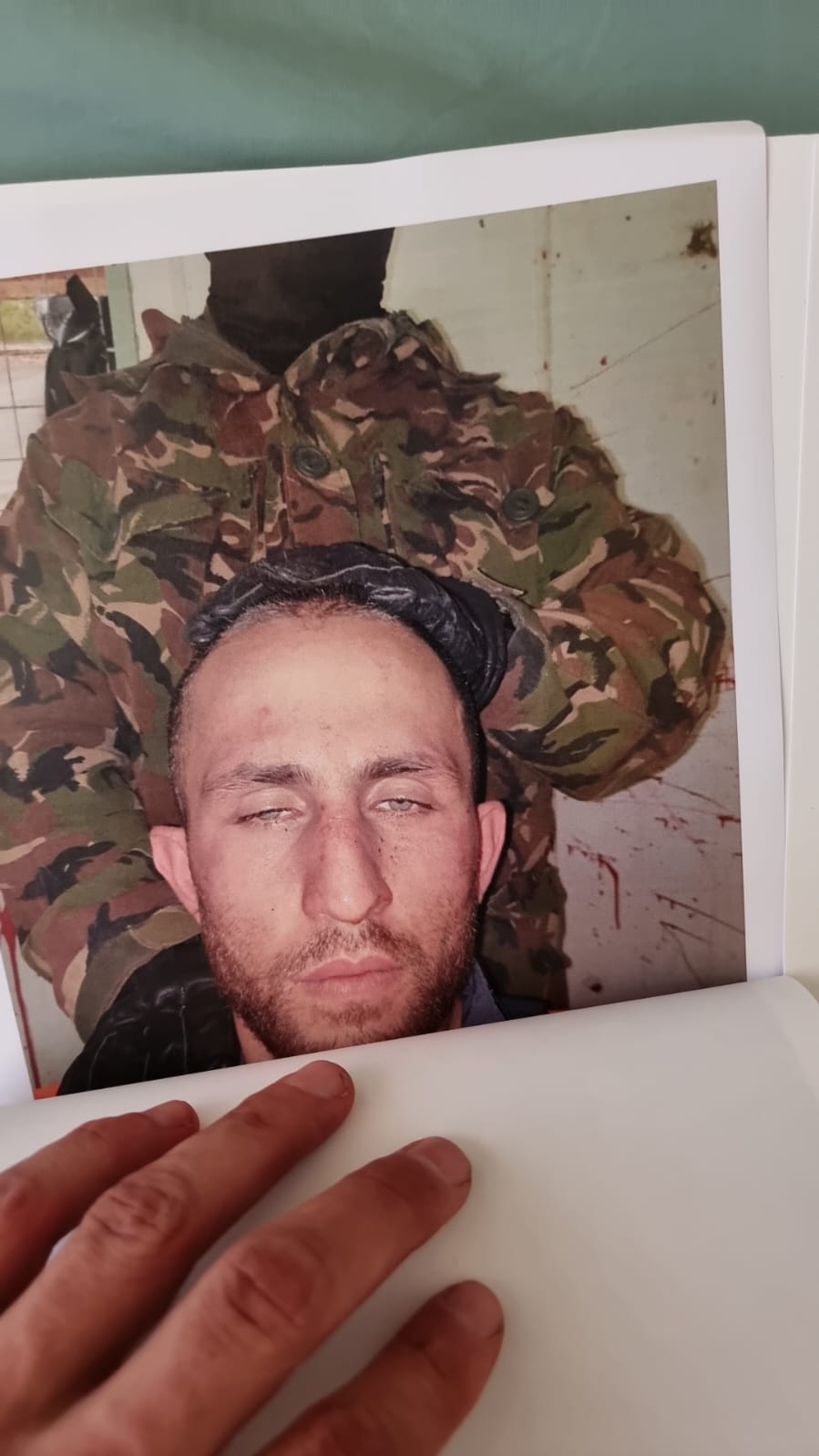
I came out unscathed from the deadfall, although I witnessed it happening only 10 metres away from me, so it was difficult to get any peaceful rest. Also, I took the time to assess the damage and found that skin was torn from my shoulders and hips, and my toenails were ripped out—the exposed nerve endings kept surging me with pain—especially when I was back on the move.
Whilst following the river, I started to feel lost, and no sight of any communities or people as my guide promised — I was not meant to take on this part of the journey alone.
I began to have muscle spasms in my legs to the point it became debilitating, where I had to just take a seat and sit with my anxious thoughts. My chest was also in pain and I believed I might have picked up some disease from the insects.
15th November 2022 13:11
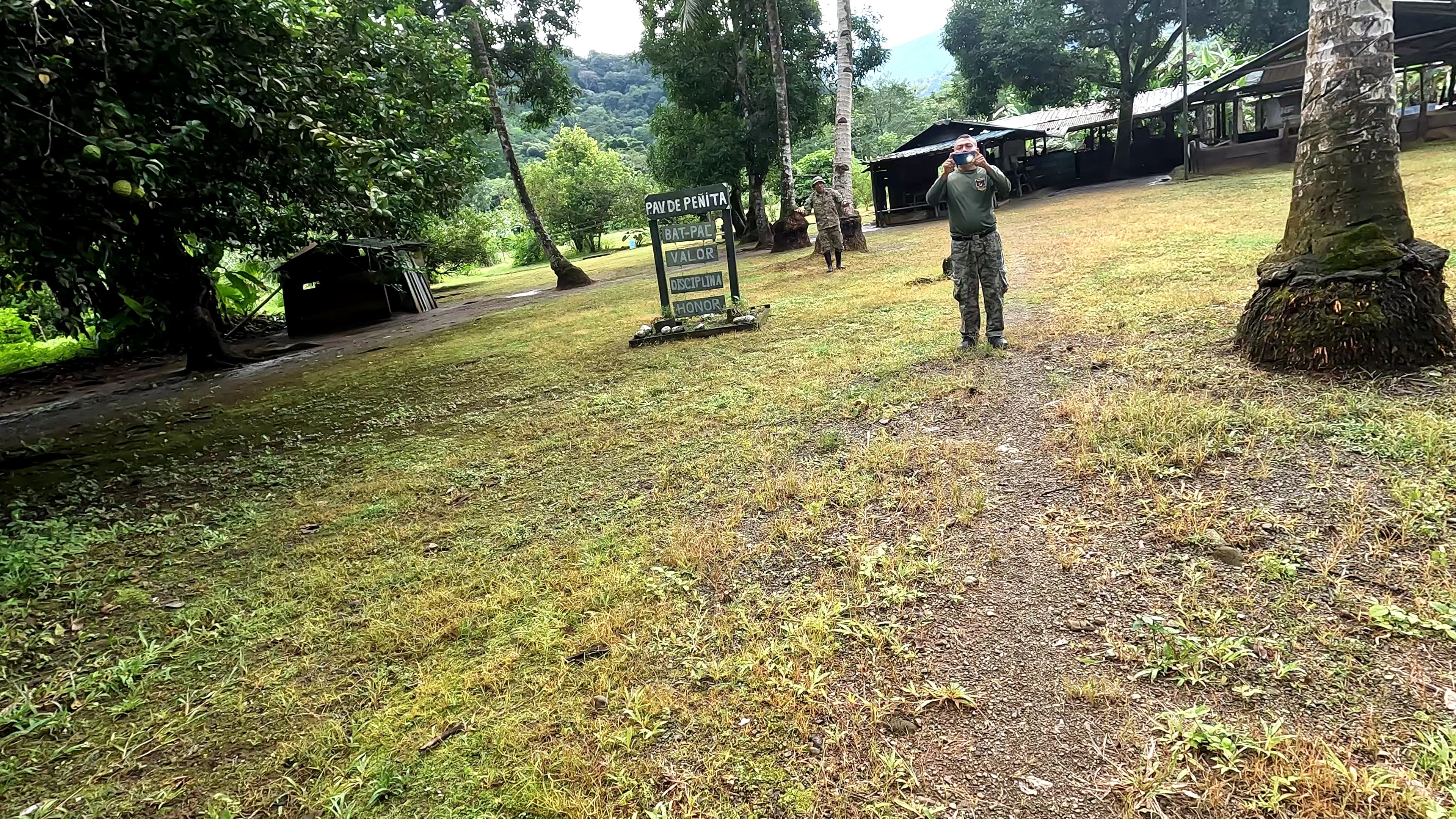
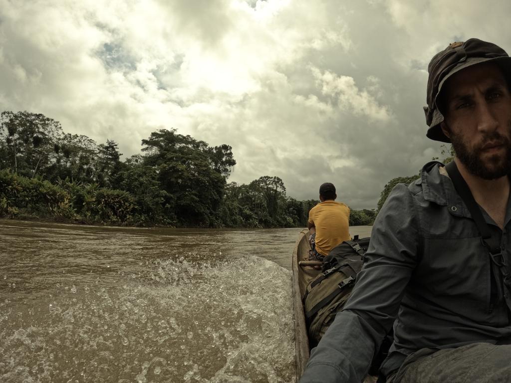
The guide and I had covered 15 miles of walking on our first day on foot in the Darién Gap. Still, we hoped to have covered more ground that day to reduce as much time spent in this hostile jungle as possible. The longer you stay, the faster you begin to break down, as though the wild slowly digests you.
We were no longer on fresh legs as we had been on day one. Now it all depended on willpower to push through on day two, where we made it into the most remote, mountainous and central region of the jungle between the start and end of this journey.
15th October 2022 20:00
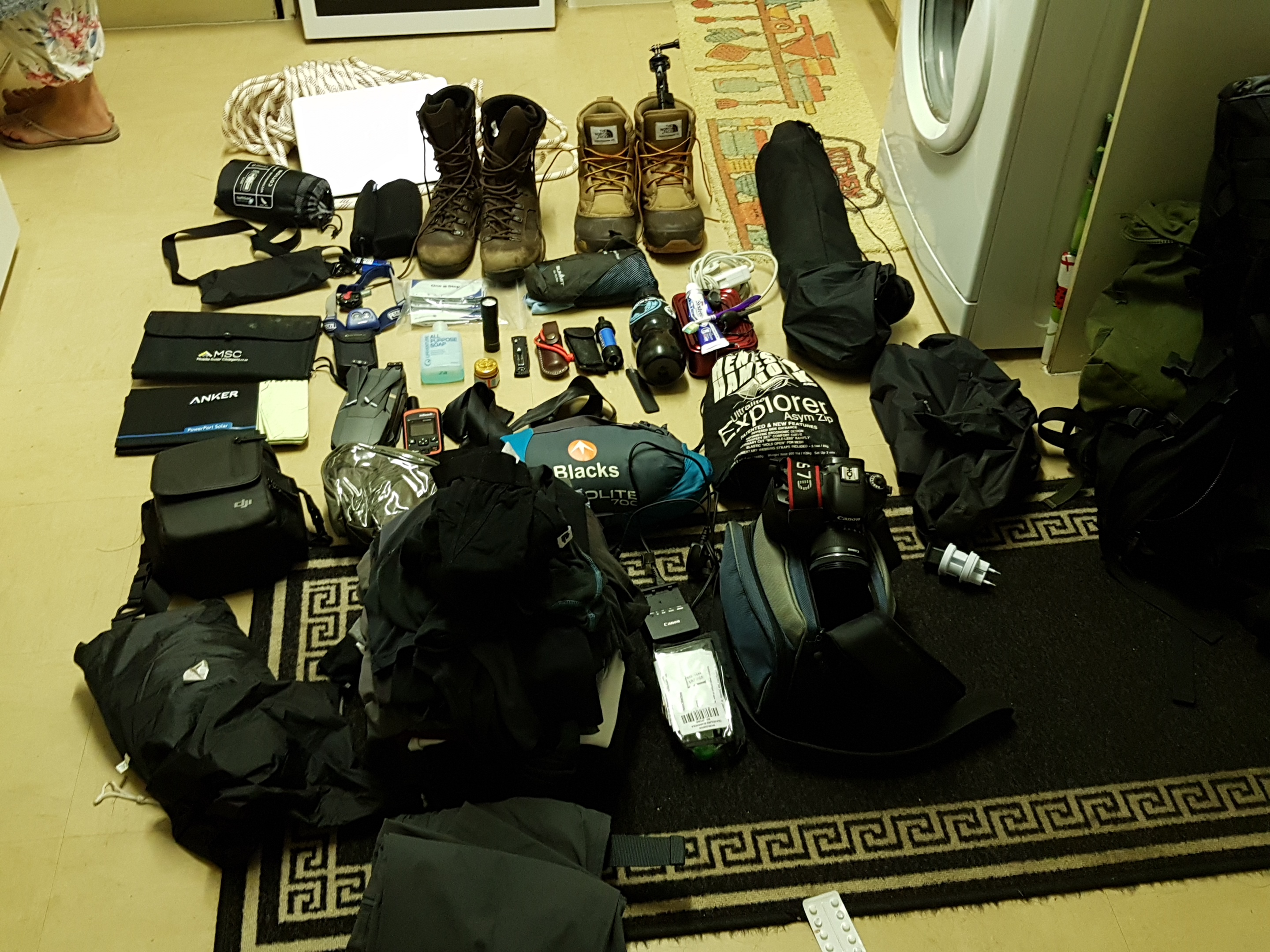
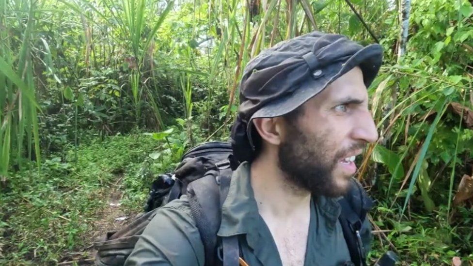
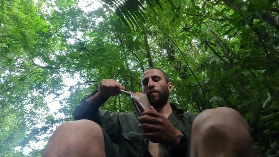
The expedition's ultimate test would finally begin after leaving the indigenous village and attempting to cross through the most extreme parts of the Darién Gap by foot carrying a 27kg backpack containing a sleeping bag, hammock, video equipment and food.
15th September 2022 11:30
A dangerous expedition will usually have one key selling point for a daring explorer, whether it’s the natural landscape that provides the challenge, perhaps political turmoil in the area, or deadly wildlife.
Few will have every risky attraction tied to their names, yet The Darién Gap has them all—with a laundry list of challenges you must face passing through this wild, remote region between North and South America.
Drawn to this hostile region was UK explorer Daniel Eggington, who had spent 5-years working towards going on this incredible expedition to cross the Darién Gap by foot. Many would deter Eggington from embarking on this mission, including legendary survivalist Bear Grylls. Still, Eggington was adamant about completing this challenge. He was further driven by the idea of educating people on the infamous region through his first-hand experience.
Still, the question lingers, what makes The Darién Gap so infamously dangerous yet spectacular?
15th August 2022 15:30
People travelling to hostile regions to cover conflict and humanitarian crises, or to expose corruption and human rights violations, face numerous threats. Not only must they consider logistical issues and medical risks, but increasingly must prepare for the threats of intimidation, harassment and violence. This does not wholly focus on people working within journalism it extends to people who travel within regions defined as hostile.
Moreover, as the lines between journalist and citizen reporter become increasingly blurred with the more widespread adoption of social media and use of smartphones, even those not typically identifying as journalists can find themselves exposed to heightened risks. In particular, governments have resorted to comprehensive surveillance measures and means of intimidation in an attempt to thwart freedom of expression and undermine democracy.
15th June 2022 19:00
The shared Border of Colombia and Panama the Darien Gap is home to one of the least exploited and most diverse regions in the world. Shareing two oceans to the north and west the pacific and to the east, the Atlantic the area includes two protected parks Panamas Darien National Park in and Los Katios National Park in Colombia. The area is 30 miles wide, from the North Pacific Ocean to the Caribbean Sea, and 54 miles in length, when measuring from the city of Yaviza in Panama in a straight line the region is home to varying landforms, from swamplands on the Colombian side to the mountainous rainforests with its tallest peak, Cerro Tacarcuna (standing at 5,535 ft or 1,845 m), on the Panamanian side. With more than 3 million acres of wilderness, the ecosystem found within is one of the most hotly contested, a political and environmental quagmire.
The region has an abundance of rare plants and wildlife. Besides being home to rare wildlife, the region is also populated by diverse groups of people from the indigenous communities, to the armed groups, which won’t go into in this post.